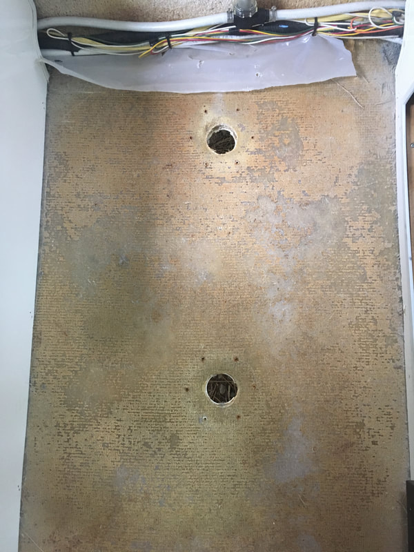
There comes a time when you have to throw away your weekend and get some important stuff done. We've been wanting to tear out the carpet in our trailer for a while and replace it with vinyl planks. So, we drove to the Home Depot in Denver and picked up the parts for our our new floor. Then, we tore out the carpet. 
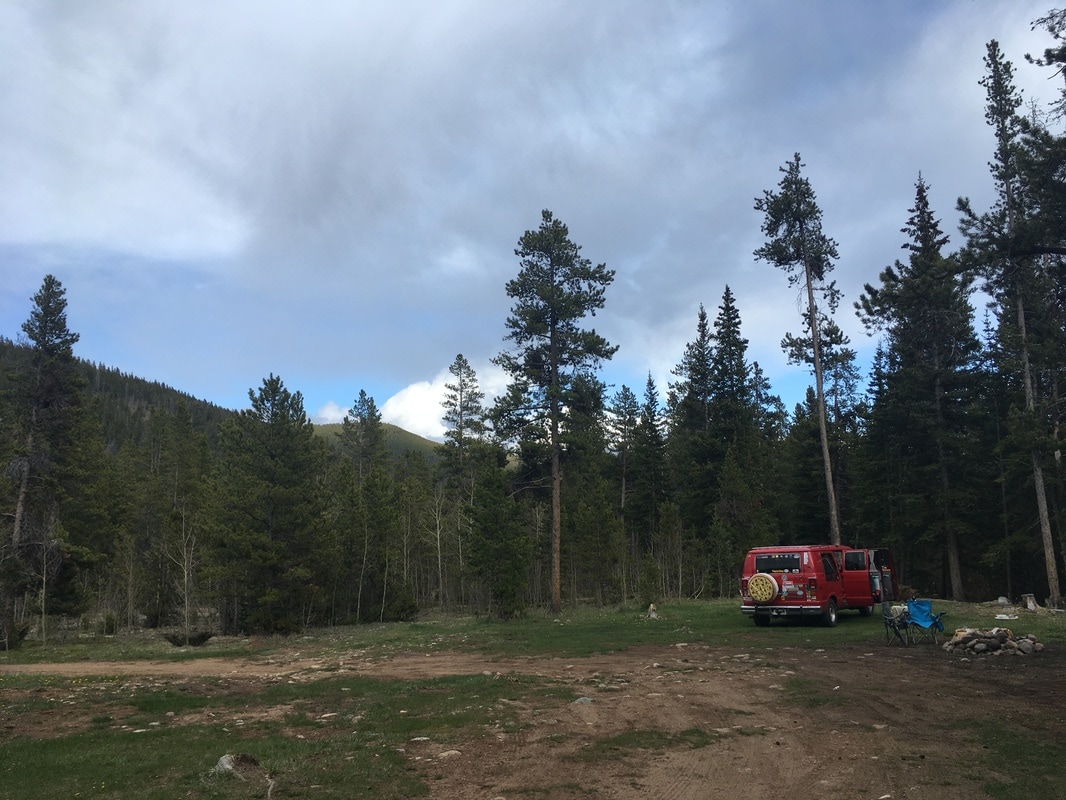
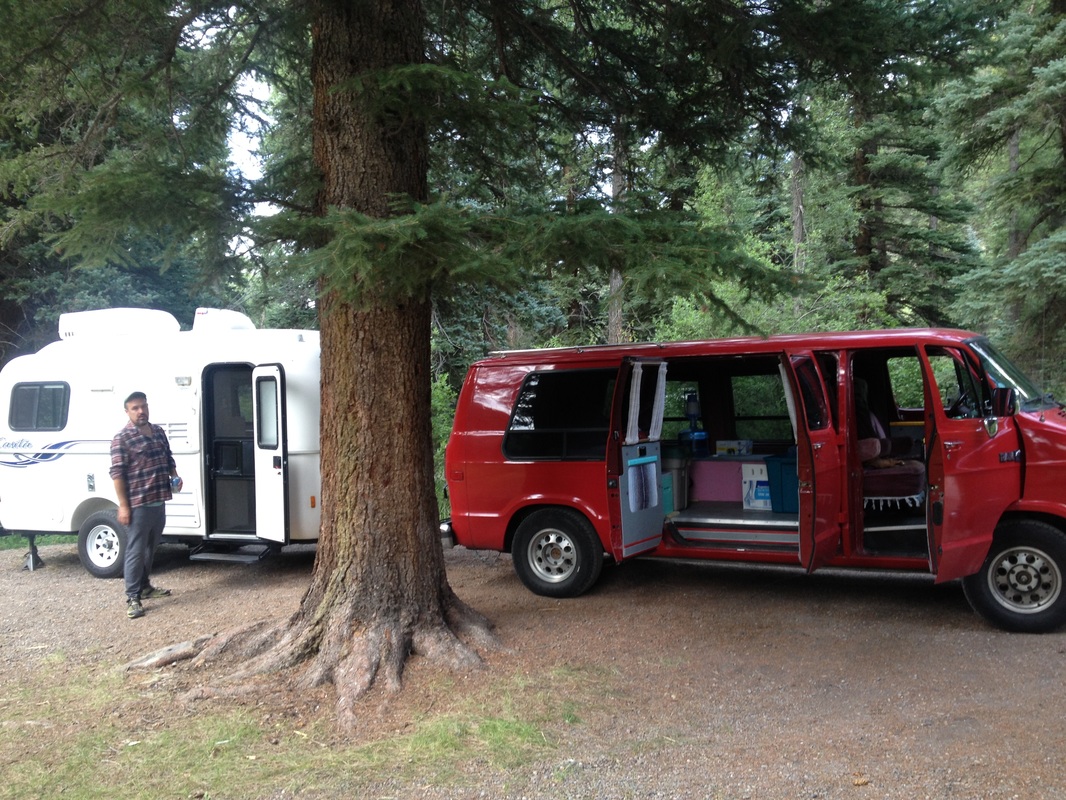
And then we realized it was too late in the day to start laying the floor.....so we went camping.
0 Comments
A few months ago, I heard a radio ad for the Crested Butte Music Festival. I pulled up the calendar on the website and found a Tuesday matinee: the dress rehearsal for a double bill of the comedic one-act operas Offenbach’s The Island of Tulipatan and Puccini’s Gianni Schicchi. I emailed my mom the information to see if she wanted to meet us there, hoping I wasn't the only one who thought driving 200 miles to the opera sounded like a fun idea. Luckily, we're a bunch of nerds and made a date! When we were searching for campsites before the trip, we were surprised to find that there weren't many camping options near town other than the Oh-Be-Joyful Campground, a first-come, first-serve campground a few miles outside of town. With our fingers crossed, we headed down four miles of dirt road and, sure enough, found an open site. The campground used to be free, but as of summer 2017 there is a $10 fee - which is a fair price for the views, vault toilets, and a creekside site. The next day we met up with my mom at her Airbnb, which happened to have a pool and was right across from the Mount Crested Butte Mirror Palace tent, where the opera was being held. We went for a dip then put on our finest and walked over to the show.
We had a busy Memorial Day weekend working at the Coney Island Hot Dog in Bailey. The weekend warriors were in full march, and we were slinging hot dogs as fast as we could through Monday. Highway 285 was a constant stream of cars, trucks, campers, rvs, and boats. Angelica and I were ready to go camping as soon as we got off work. We headed up the recently opened Guanella Pass around 5 pm. All the traffic was headed in the opposite direction, back to Denver.
We found a lovely spot in the recently abandoned free campground on the pass, lit a fire, opened the wine, and relaxed. It was a great evening. Kenny and I spent the first three weeks of 2017 traveling down the Natchez Trace Parkway from Nashville to Natchez. If you missed week 1 and 2, you can catch up here and here. We left off last week a little off the Trace at Goshen Springs Campground where we had to get our van fixed. Now, we're at the final campground on the Trace: Rocky Springs. Week 3: Camping at Rocky SpringsJanuary 17, 2017 On December 31, 2016, we started down the Natchez Trace Parkway from Nashville, Tennessee. It took us a slow and meandering twenty-one days to drive the 444-mile parkway to Natchez, Mississippi - speed obviously not being the goal. It's now the beginning of May 2017, and I considered skipping over this part of our journey, since it's anything but timely. However, this is my blog, dammit (!), and the history of the Natchez Trace spans back tens of thousands of years, so I'll consider these past four months between us and the Trace but a blink of an eye in the grand scheme. I'm going to share some excerpts from my journal and pictures from this quiet, isolated, and damp piece of America, but, first, a little context. Big Red Gets StolenOur winter plan went something like this: 1) Work the sugar beet harvest in October, 2) work at the Amazon Fulfillment Center November through the end of December, 3) buy a generator with our savings, and 4) take the next three months off boondocking in the southwest until our summer job in Colorado. But, on the way from the sugar beet harvest in Drayton, North Dakota to our next job at an Amazon Fulfillment Center in Murfreesboro, Tennessee, we stopped for an afternoon in downtown St. Louis... where our van was stolen. Miraculously, it was found a week later, and even more miraculously, still in running order. We had a GoFundMe campaign that helped lighten the blow, but because of van repairs, car rentals, and buying a new tow vehicle to get us to our next job in Tennessee, our nest egg was broken. After we were done working at Amazon we had a couple options: 1) go crying to Mom or 2) forget about buying a generator, camp cheap and live off of beans and rice until our next job. And beans and rice won out! So, we took a look at the map and looked for a new route to get south, then west. And there it was, a long vein that avoided highways and interstates, a place we had never heard of. Forty miles from where we sat, stretching through part of Alabama, and deep into Mississippi: The Natchez Trace Parkway. History of the Natchez Trace ParkwayThe Natchez Trace Parkway is a paved road that follows much of the "Old Trace" - a natural trail originally trampled down by bison and other large game. Overtime, it became a footpath for travelers. Native Americans were the first to use the path as a sort of highway. Boatmen, called "Kaintucks", would float supplies down the Mississippi or Ohio river to sell at busy hubs, like Natchez and New Orleans. They would also sell the planks of wood that made their flatboats, and then hike back home, 400 + miles north toward Nashville on the Natchez Trace. Explorers, soldiers, and slave traders are also part of the ancient path's more modern history. With the introduction of the steamboat, traders could more efficiently bring goods down the river and complete their return trip upriver by boat, making the Trace obsolete. In the early 1900s, a group of women known as the Mississippi Daughters of the American Revolution made it their duty to preserve the forgotten and historic Trace. Due to their efforts, the Natchez Trace Parkway was designated a national park in 1938. The parkway is a leisurely drive with a maximum speed of 50 mph. Also a designated bike path, motorists share the road with many cyclists in the summer months. The three campgrounds along the Trace have no hookups, but they are free and anything but primitive otherwise, with paved sites and heated bathrooms. Week 1: Camping at Meriwether Lewis + Tombigbee State ParkWe spent last summer working at Hart Ranch RV Resort in Rapid City, South Dakota. We had every Tuesday-Wednesday off. On Monday, we'd get off work around 2:00 pm, load up the van, ditch the trailer, and go camping! We were so obsessed with exploring the Black Hills, both after work and on the weekends, that we seriously neglected documenting our adventures on our blog. So here you go. Nearly a year later, and just in time for you to plan a summer trip, here's our love letter to the Black Hills. I hope you get inspired to go explore South Dakota and fall in love with the Black Hills! The StratobowlThe Stratobowl was only a few miles from where we were living, but about 12 miles from Rapid City proper. If you're traveling south on Highway 16 from Rapid City, start looking for a small parking lot after Bear Country and directly after you pass the gas station. On the first try, you'll probably see it as you cruise by, but you can get off at Rockerville to turn around and turn in to the parking lot from northbound Highway 16. The Stratobowl was put on the map in 1934 when it was home to a stratospheric balloon launch site sponsored by the National Geographic Society and the US Army Air Corps. In the 1950s, it was also used by the US Navy Project Strato-Lab. The trail is only about 1/2 mile uphill to the overlook, but if you're looking for a longer hike, continue past the overlook until you come to a fork. If you go straight, you'll end up on private property in another 1/2 mile. If you take a left, you'll get another view of the canyon. If you go right, the trail continues on a dirt road that we never found the end of. In the late summer, you can also see hot air balloons take off during the Stratobowl Historic Hot Air Balloon Event. This hike is dog friendly and great for trail running. The Flume Trail Just a short drive from Rapid City, the Flume Trail runs 11 miles one way, with an optional 3-mile loop in the middle section. This moderate and quiet trail follows the path of the historic Rockerville Flume that used to carry water 20 miles from Spring Creek, South Dakota to Rockerville, South Dakota until 1885.
The plan was to head out camping for the weekend after work, but that plan got hailed on. We reluctantly stayed home and headed out the next morning to the Deerfield Lake Recreation Area. Deerfield Recreation Area has three campgrounds: Custer Trail, Dutchman, and Whitetail. We drove through all of them and campsites were available, but we decided to stay at an outlying campground Ditch Creek. Most of the campsites we've stayed in around the Black Hills have been creekside and there's nothing better at the end of the day than getting in our van-bed, opening the windows, and falling asleep to the sound of a creek. Once we got to Ditch Creek, we were glad we decided to wait out the storm and camp the following night. Baseball-size hail had broken vent covers on at least two RVs in the storm and piles of hail still stood on the ground.
|
The Campers
|