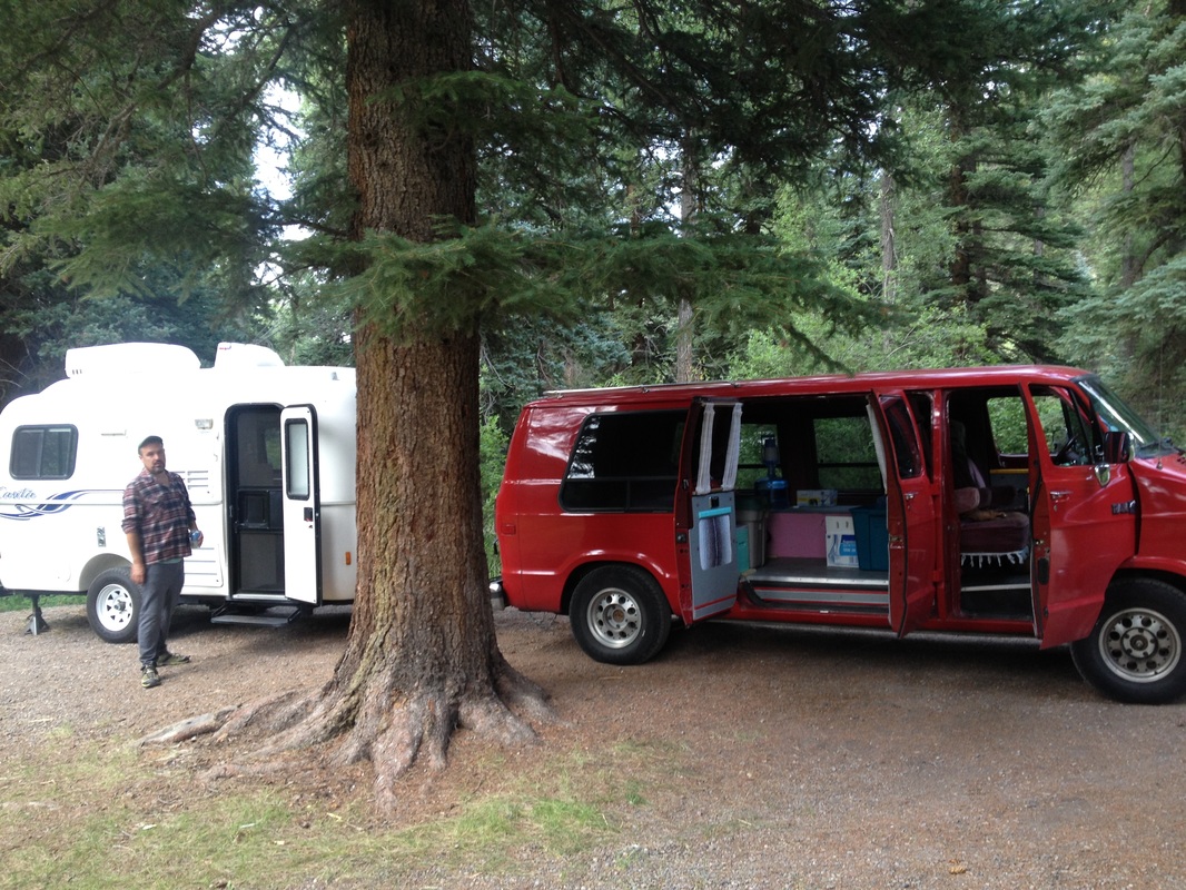
We spent last summer working at Hart Ranch RV Resort in Rapid City, South Dakota. We had every Tuesday-Wednesday off. On Monday, we'd get off work around 2:00 pm, load up the van, ditch the trailer, and go camping! We were so obsessed with exploring the Black Hills, both after work and on the weekends, that we seriously neglected documenting our adventures on our blog. So here you go.
Nearly a year later, and just in time for you to plan a summer trip, here's our love letter to the Black Hills. I hope you get inspired to go explore South Dakota and fall in love with the Black Hills!
Nearly a year later, and just in time for you to plan a summer trip, here's our love letter to the Black Hills. I hope you get inspired to go explore South Dakota and fall in love with the Black Hills!
The Stratobowl
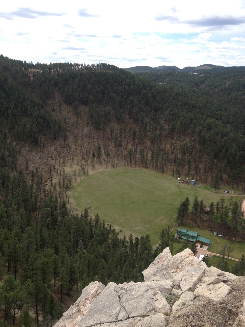
The Stratobowl was only a few miles from where we were living, but about 12 miles from Rapid City proper. If you're traveling south on Highway 16 from Rapid City, start looking for a small parking lot after Bear Country and directly after you pass the gas station. On the first try, you'll probably see it as you cruise by, but you can get off at Rockerville to turn around and turn in to the parking lot from northbound Highway 16.
The Stratobowl was put on the map in 1934 when it was home to a stratospheric balloon launch site sponsored by the National Geographic Society and the US Army Air Corps. In the 1950s, it was also used by the US Navy Project Strato-Lab. The trail is only about 1/2 mile uphill to the overlook, but if you're looking for a longer hike, continue past the overlook until you come to a fork. If you go straight, you'll end up on private property in another 1/2 mile. If you take a left, you'll get another view of the canyon. If you go right, the trail continues on a dirt road that we never found the end of. In the late summer, you can also see hot air balloons take off during the Stratobowl Historic Hot Air Balloon Event. This hike is dog friendly and great for trail running.
The Stratobowl was put on the map in 1934 when it was home to a stratospheric balloon launch site sponsored by the National Geographic Society and the US Army Air Corps. In the 1950s, it was also used by the US Navy Project Strato-Lab. The trail is only about 1/2 mile uphill to the overlook, but if you're looking for a longer hike, continue past the overlook until you come to a fork. If you go straight, you'll end up on private property in another 1/2 mile. If you take a left, you'll get another view of the canyon. If you go right, the trail continues on a dirt road that we never found the end of. In the late summer, you can also see hot air balloons take off during the Stratobowl Historic Hot Air Balloon Event. This hike is dog friendly and great for trail running.
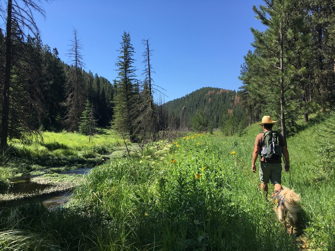
The Flume Trail
Just a short drive from Rapid City, the Flume Trail runs 11 miles one way, with an optional 3-mile loop in the middle section. This moderate and quiet trail follows the path of the historic Rockerville Flume that used to carry water 20 miles from Spring Creek, South Dakota to Rockerville, South Dakota until 1885.
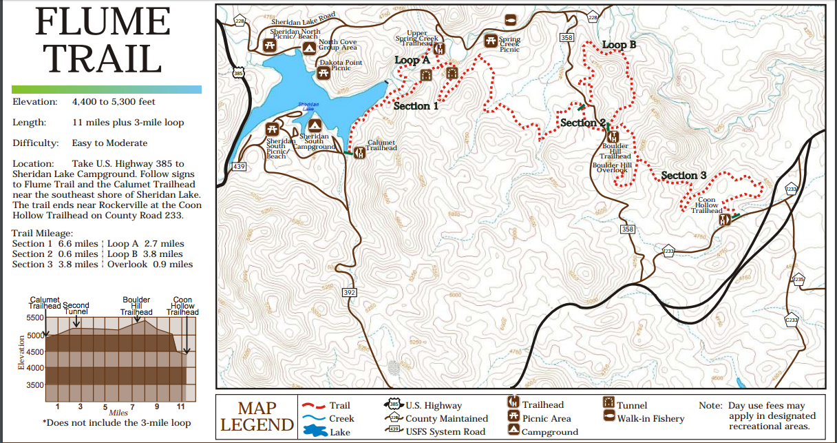
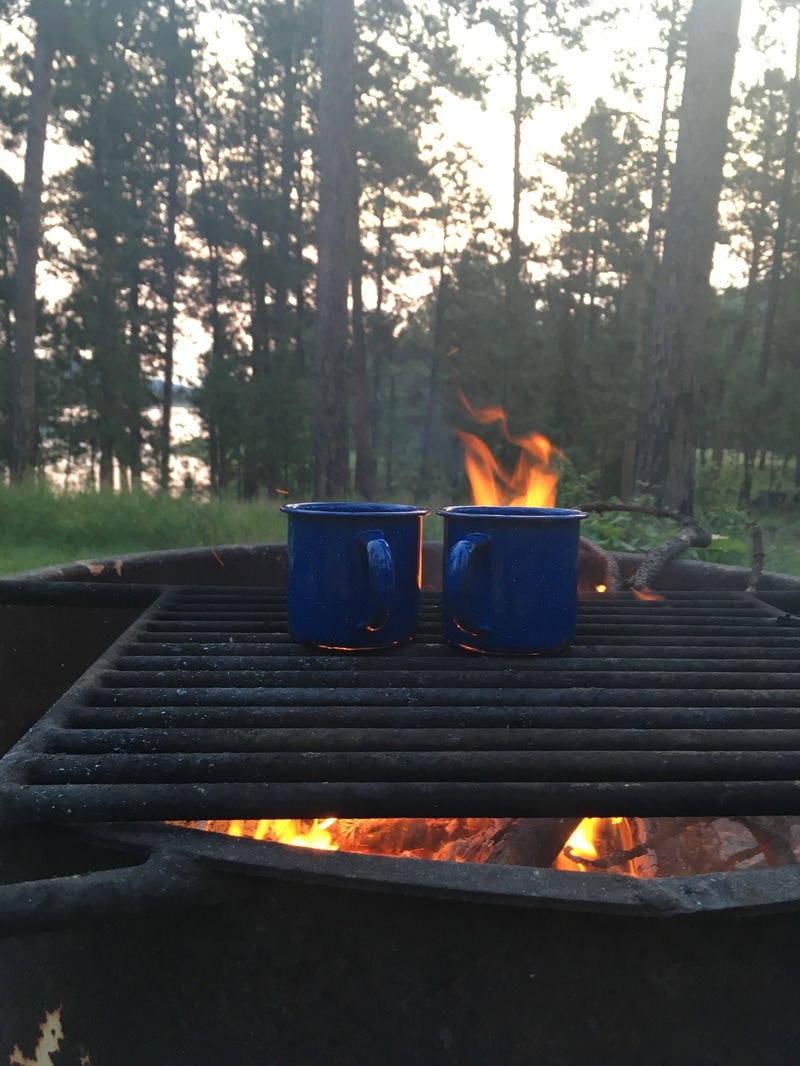
The Flume has three trailheads, which divide the trail into three sections: Coon Hollow, Boulder Hill, and Sheridan Lake/Calumet. We often did one section of the trail - each only about 4-6 miles - as an after-work hike. (More pics from sections of the Flume on our Facebook page here and here). And, on one of those day hikes, we decided we should backpack the whole trail. So, a few weeks later, we threw on our packs and hiked from Coon Hollow to Sheridan South Campground, where we went swimming and camped for the night.
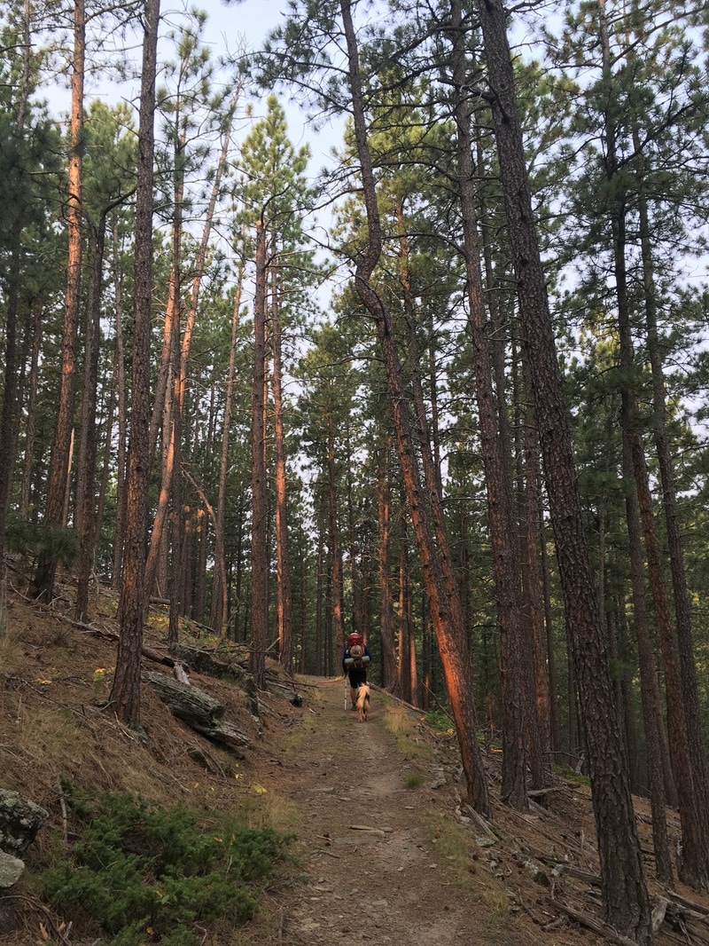
From Coon Hollow, heading to Boulder Hill
View of Boulder Hill in the background
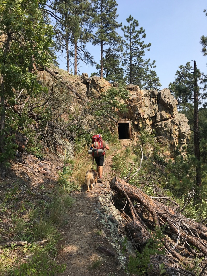
One of two tunnels before reaching Sheridan Lake
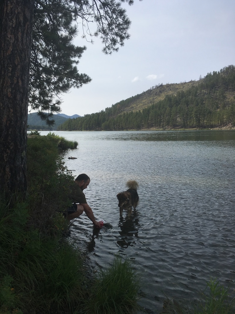
Cooling off in Sheridan Lake
Good morning! Time to head back.
If you're considering doing the hike in its entirety, take a more detailed map than the one provided by the forest service, like the National Geographic map 751 of Black Hills North, which we left in the van on our trip. You'll be glad you have it when you're well off the trail, without cell service, and wondering what road you're standing on. There were a few missing signs along the route that sent us hiking a mile in the wrong direction (one wrong turn took us uncomfortably close to someone's shooting practice), so keep an eye out and if you feel like you're not on the trail, you probably aren't. Turn around and scan the trees and ground for fallen clues and trails off in the trees.
Custer State Park
Go to Custer State Park - even the drive is worth the trip! A few times, we got off work and drove halfway (15 miles) to Grizzly Bear Campground on the Peter Norbeck Scenic Byway just to get out, then drove the remaining 20 miles in the morning to Custer State Park to hike. This campground gets packed on the weekends in the summer, but we were lucky to have weekdays off and always found a spot last minute.
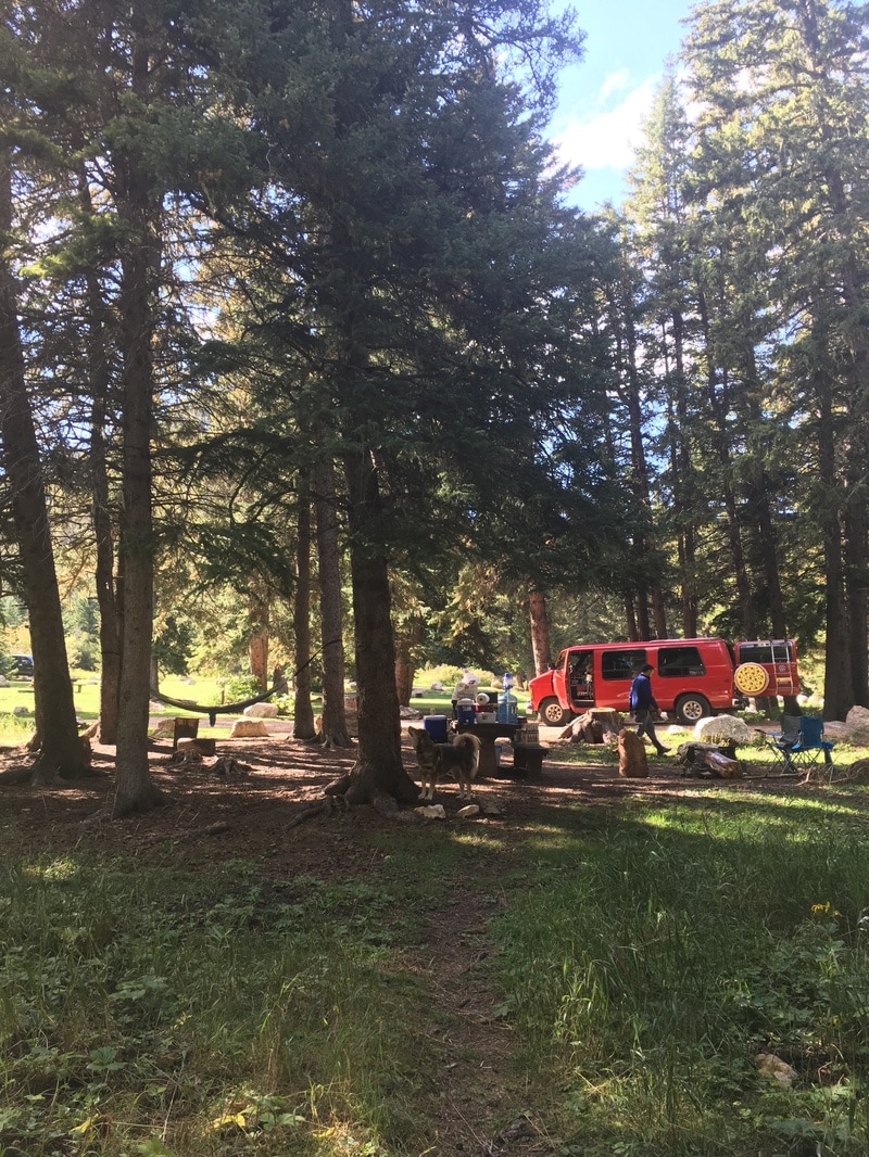
Of course, there's plenty of camping to do in Custer State Park's eight developed campgrounds, although a little more expensive and crowded. We stayed at most of the campgrounds in the park, but our favorite was Lower Center Lake Campground, preferably the sites near the creek. With plenty of trees to hang a hammock, a generous amount of space, and a short walk to the lake for a swim, you'll never want to leave.
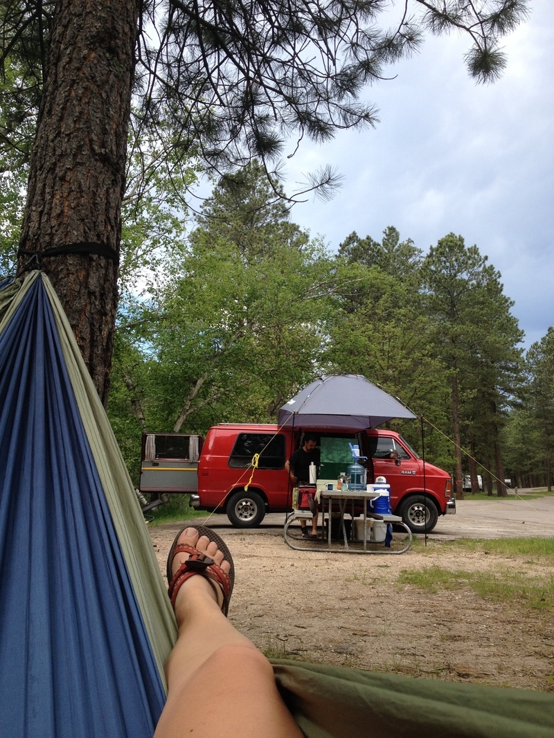
Set up at Center Campground watching Kenny cook
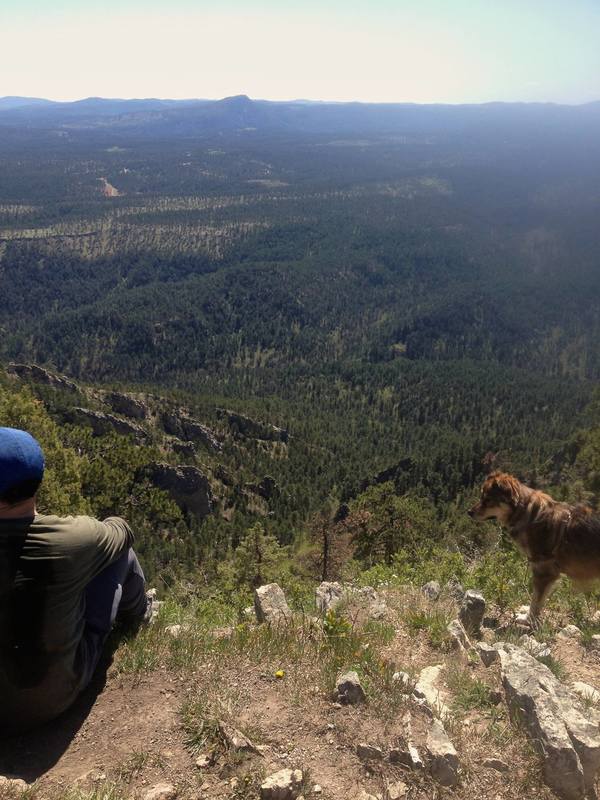
In the 17,000 acre park, there's no shortage of hiking trails, but the big draw is Harney Peak. At 7264 feet, Harney Peak is the highest point in South Dakota. Atop the peak sits a historic fire lookout tower constructed by the CCC in 1938 that was still in use until 1967. Unfortunately, Harney Peak is really cool and is in danger of being "loved to death" from all the summer visitors. The park asks visitors to consider taking less popular routes, than primary trail #9. On our first trip, we took trail (#4) on the way up and took the primary trail (#9) down, making it a 6.8 mile loop. We also accessed Harney Peak from the Cathedral Spires trailhead. Our route incorporated the 1.5-mile trail (one way) to awesome closeup views of the Cathedral Spires. Then over to Little Devils Tower, where you can connect with trail #4 to Harney Peak if you want a longer hike. More pics of our hike to Harney Peak on our Facebook page.
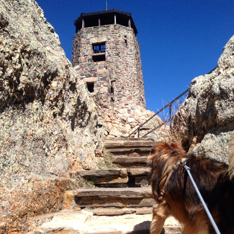
Harney Peak
The other trail you won't want to miss is Sunday Gulch, which is accessed from from the back of the Sylvan Lake Trail and is about 4 miles. Sylvan Lake is always hopping, but you'll lose the crowd as soon as you get onto the Sunday Gulch Trail. The trail is a loop so you can start at either end, but we preferred going counter-clockwise because it was easier to descend with assistance by the handrails into the gulch than to climb out.
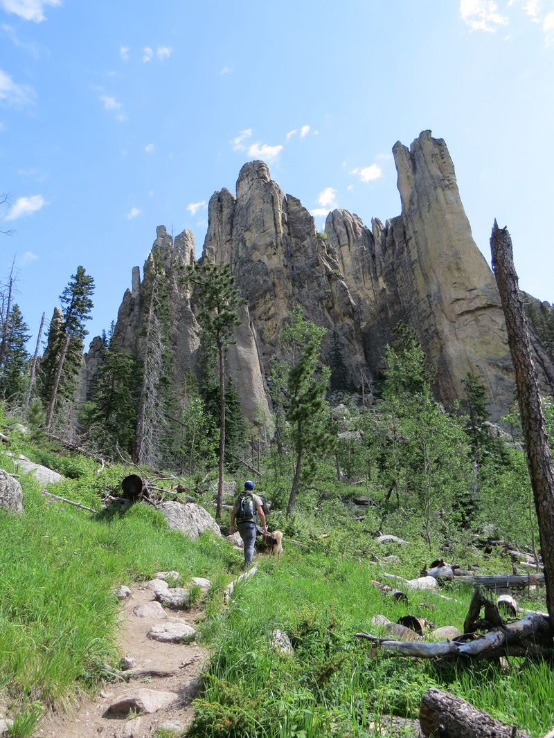
Cathedral Spires
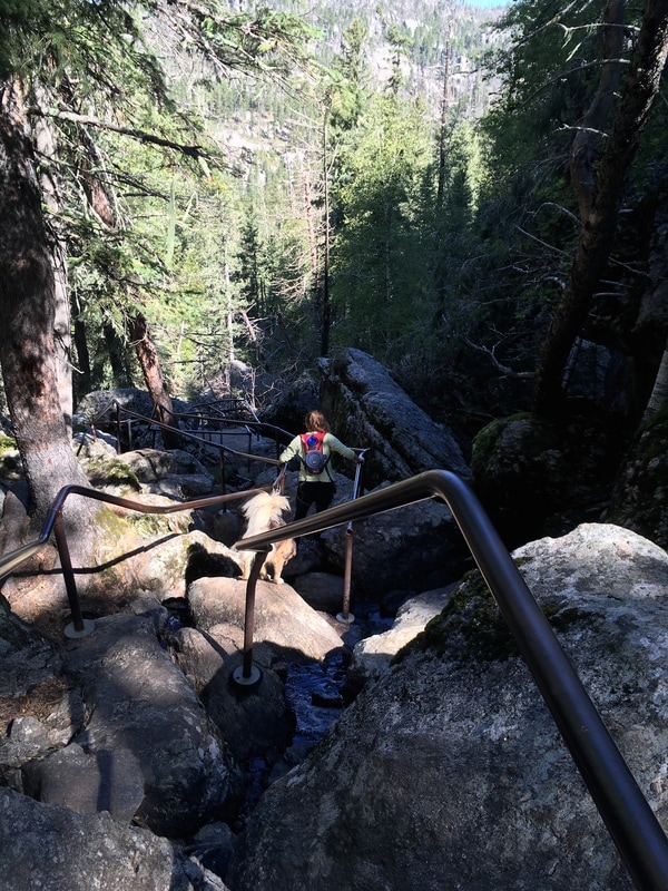
Sunday Gulch
Spearfish Canyon
And when we weren't in Custer State Park, we were in Spearfish Canyon. If you want to escape the crowds on the trail or at camp, at the southern end of Spearfish Canyon at the town of Savoy, turn into Roughlock Falls, and keep going until the road becomes a dirt road. Down this road are two small campgrounds: Rod & Gun and Timon. In the half dozen or so times we stayed at the campgrounds, we always found a spot - sometimes we were the only ones there, sometimes we had a far off neighbor, and rarely were they near full.
Camping at Timon Campground next to the creek
Easily accessible from either campground are three trails: Little Spearfish Trail, Rimrock Trail (upper loop and lower loop), and Old Baldy Trail. A short jaunt from Timon Campground, Little Spearfish Trail is a 6-mile loop that begins by following a creek with abundant wildflowers and fritillaries, then winds through dense forests of ponderosa pines. Learn more about the area on this forest service brochure.
From the Rod & Gun Campground, you can directly access the trailhead to the Lower Loop of the Rimrock Trail (3.2 miles). On the trail you have a choice to finish the loop and return back to your campsite or continue on an additional 4.7 miles on the Upper Loop of the Rimrock Trail. With luscious greens and flittering wildlife-- as well as free roaming cows--this hike also has high reaching granite cliff walls covered in moss. If you're feeling especially spry and adventurous, you can even continue on to the .09 mile spur trail that takes you to Old Baldy Trail, where you can summit Old Baldy.
We did hike and summit Old Baldy, but on a different day and from the Old Baldy Trailhead just down the road. We wrote a whole blog on this trip that you can find more about here.
We did hike and summit Old Baldy, but on a different day and from the Old Baldy Trailhead just down the road. We wrote a whole blog on this trip that you can find more about here.
Little Spearfish Trail
On the other end of Spearfish Canyon, near the town of Spearfish, is Crow Peak. This hike is 3.2 miles up, and 3.2 miles down with an elevation gain of 1,560 feet. It's a gentle enough climb up, but you'll want to stop and take in the landscape of the Northern Black Hills before you head down. Learn more about this area on this forest service brochure.
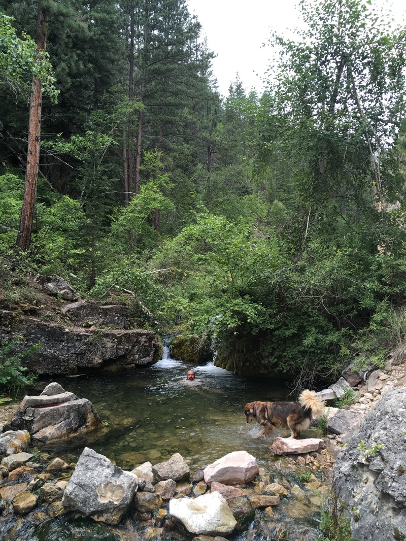
And, if after a weekend of hiking and camping, you feel like doing one last hike to the coldest swimming hole your toes have ever touched, go back out to Savoy at the southern end of Spearfish Canyon to Iron Creek. This is an unofficial trailhead, but if you're heading south out of Spearfish Canyon (Alt Highway 14), you'll cross a tiny bridge with a sign that says "Iron Creek" and off to your left is a parking lot, which will probably have at least one car parked in it. Follow the trail up and jump into any swimming hole that looks most inviting. We never ventured to the end, but legend has it, if you continue up the hill to a barbed wire fence, which everyone steps over, and keep on going, you'll end up at Iron Creek Lake in about 3 miles.
Oh, and get in your car or on your bike and ride through Spearfish Canyon already!
 | Angelica has a BA in English and worked as an editorial/web manager for a Denver-based education company before hitting the road. She grew up in Grand Junction, CO working at her grandparent's amusement park. One of her favorite things is trail running with her dog. |

 RSS Feed
